THE RIVER FROME’S CONTRIBUTION TO THE PROSPERITY OF DORCHESTER (PART 2)
Ian Gosling,
Chair, Dorchester Civic Society
The early English settled in Dorchester because of its defensive position at what is now Top of Town, the proximity of the river Frome winding through the valley below and the ease with which it was possible to walk or ride to other settlements along the crest of the downs, above any flooded land. The river Frome rises at Evershot and flows south-east along chalkland valleys and is joined by Wraxell Brook, the River Hooke, Sydling Water and the River Cerne before emptying into Poole Harbour just below Wareham.
During the medieval period the religious houses exploited the rivers and the adjacent land to create fish pools and to grow their crops on the riverbanks. They came to realise that the land flooded by the rivers was more fertile than the higher land, which led to their abbeys, priories and other buildings being built close to, or adjacent to streams. Often their wastewater was made to drain into the streams flowing through low lying banks, thus fertilising the land downstream.
The Frome had its share of religious settlements, such as Bindon Abbey and the Friary adjacent to the growing town of Dorchester, at what is now the end of Friary Lane. After the dissolution of the religious houses at the end of the 16th century as a result Henry VIII’s break with Rome, the lands previously exploited by the religious orders were sold or given to the local nobility or other wealthy persons who were very keen to fructify them.
As the century progressed those landowners farming the valleys of south and western England came to realise that the clear fast flowing streams, like the River Frome, were ideal for the irrigation of the meadows they crossed. Their constant temperature and the nutrient-rich sediments they transported encouraged the growth of grass for grazing herds earlier in the year than on the surrounding downland. In this way the meadow land produced abundant grass feed for large flocks of sheep in the early spring, when the stocks of winter feed were exhausted and when the natural growth of grass would not otherwise have commenced.
By the early 17th century, the hinterland of Dorchester was celebrated for the immense number of sheep that were reared there. Thus, Daniel Defoe remarked in his book ‘A Tour Through the Whole Island of Great Britain’, first published in 1724-6, that “there were 600 thousand sheep fed on the downs, within six miles of the town”.
The practice of creating water meadows in Dorset to achieve this objective had commenced by the very early 17th century and the first fully developed system appears to have been created on the River Piddle, at Affpuddle. It was certainly in existence before the publication in 1610 of Roland Vaughan’s manual ‘Most Approved and Long Experienced Water-Workes’, but it is not clear from where the irrigation systems, and the skills, necessary to create extensive water meadows originated, although there is conjecture that engineers from the Low Countries may have been involved.
Successful water meadows required a complex and costly system of levels and channels managed by sluices, hatches and drains, and associated bridges, causeways and walls, maintained and managed by skilled ‘drowners’, to ensure that the water from the river was kept moving over the land when it was ‘floated’ in the winter. Had it been left to stagnate it would have lost its constant temperature (54-58° F) and would have suffocated and/or frozen the roots of the grass.
The development of the Dorchester water meadows enabled the creation of a very intensive and profitable agricultural cycle maximising the yield of the down and river land surrounding the town, which fuelled its growth in importance as an agricultural hub in the 17th, 18th and 19th centuries.
This cycle started by ‘floating’, or watering, the meadows at the beginning of the year, enabling the early grazing of large flocks of sheep close to the town from March to May, when they were moved to feed on the new grown grass on the downland above. There followed the production of an abundant hay harvest from the fertilized water meadows in early summer. After the harvest of the hay (and in some cases after a second harvest of hay following further watering), the meadow land was given over to the grazing of cattle during the late summer when the drier conditions would ensure that their hooves would not damage the intricate network of channels and drains.
William Cobbett writing in 1826 commented, “Every farm has its portion of down, arable and meadow, and in many places, the latter are watered meadows, which is a great resource where sheep are kept in flocks, because these meadows furnish grass for the suckling ewes early in spring; and indeed, because they always have food in them for sheep and cattle of all sorts.” More than one hundred and fifty-years earlier, Robert Seymer, of Hanford near Blandford, had reported in a paper delivered to the Royal Society in London in 1665 that, “….the greatest improvement they [farmers] have for their ground is by winter watering of it, if it lye convenient for a River or lesser streame to run over it”. These managed water meadows became an integral part of the landscape surrounding Dorchester, leading Thomas Hardy to describe the view over the meadows from the heights of Egdon Heath as “meadows watered on a plan so rectangular that on a fine day they look like silver gridirons.”
After more than three hundred years of active management of the floating of the water meadows around Dorchester, the priorities in agriculture changed radically. There was a dramatic decline in the herds of sheep grazed around Dorchester prompted by the conversion of the land to arable farming and intensive dairy farming introduced during the war years in the 1940s. This trend intensified after the war because of the increasing scarcity and cost of agricultural labour which reinforced the change and led to the abandonment of the ‘flooding’ infrastructure and to increased drainage of the area. The manpower necessary to maintain the system is evident from this photograph taken in the 1930s (Photo 1).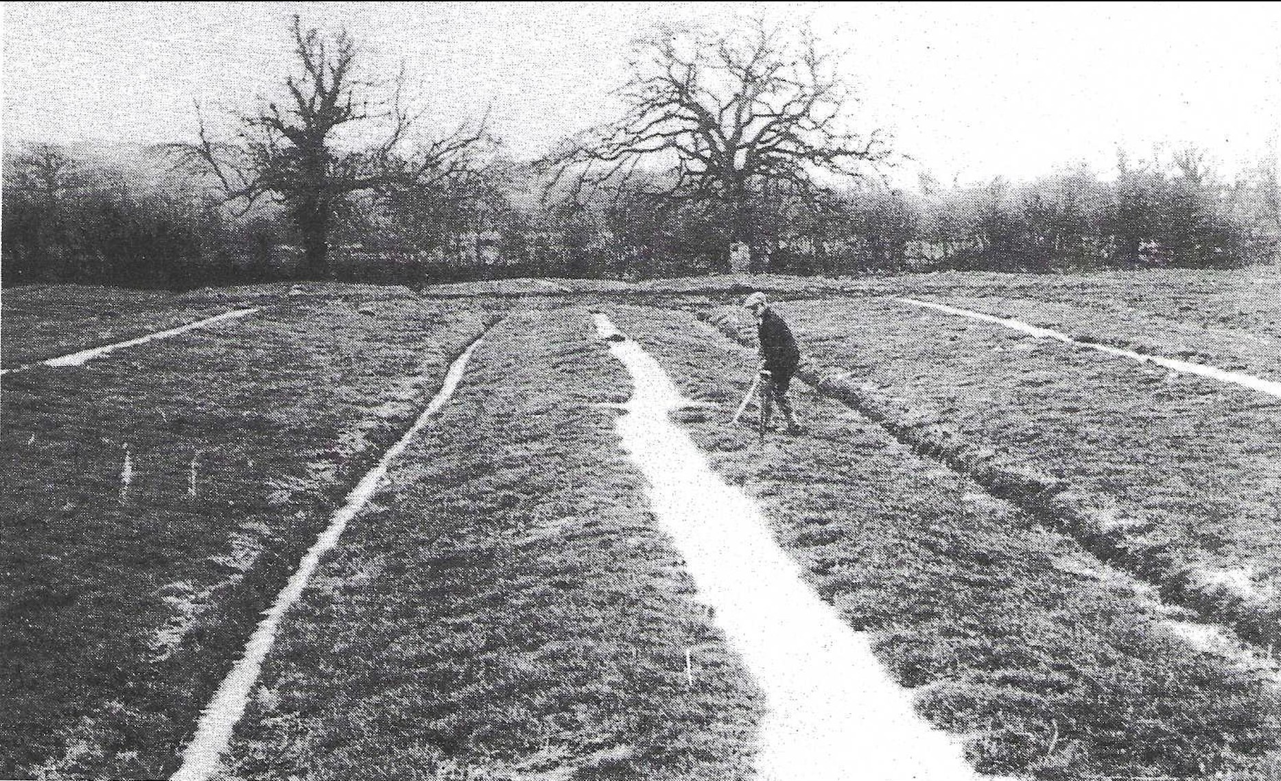
Notwithstanding this radical change in land use, the view over the water meadows from the top of Poundbury Camp, when the Frome is running high, is like ‘a gridiron’ as Hardy described it more than a hundred years ago, and the system remains perfectly visible to anyone walking the land today (see Photo 2). 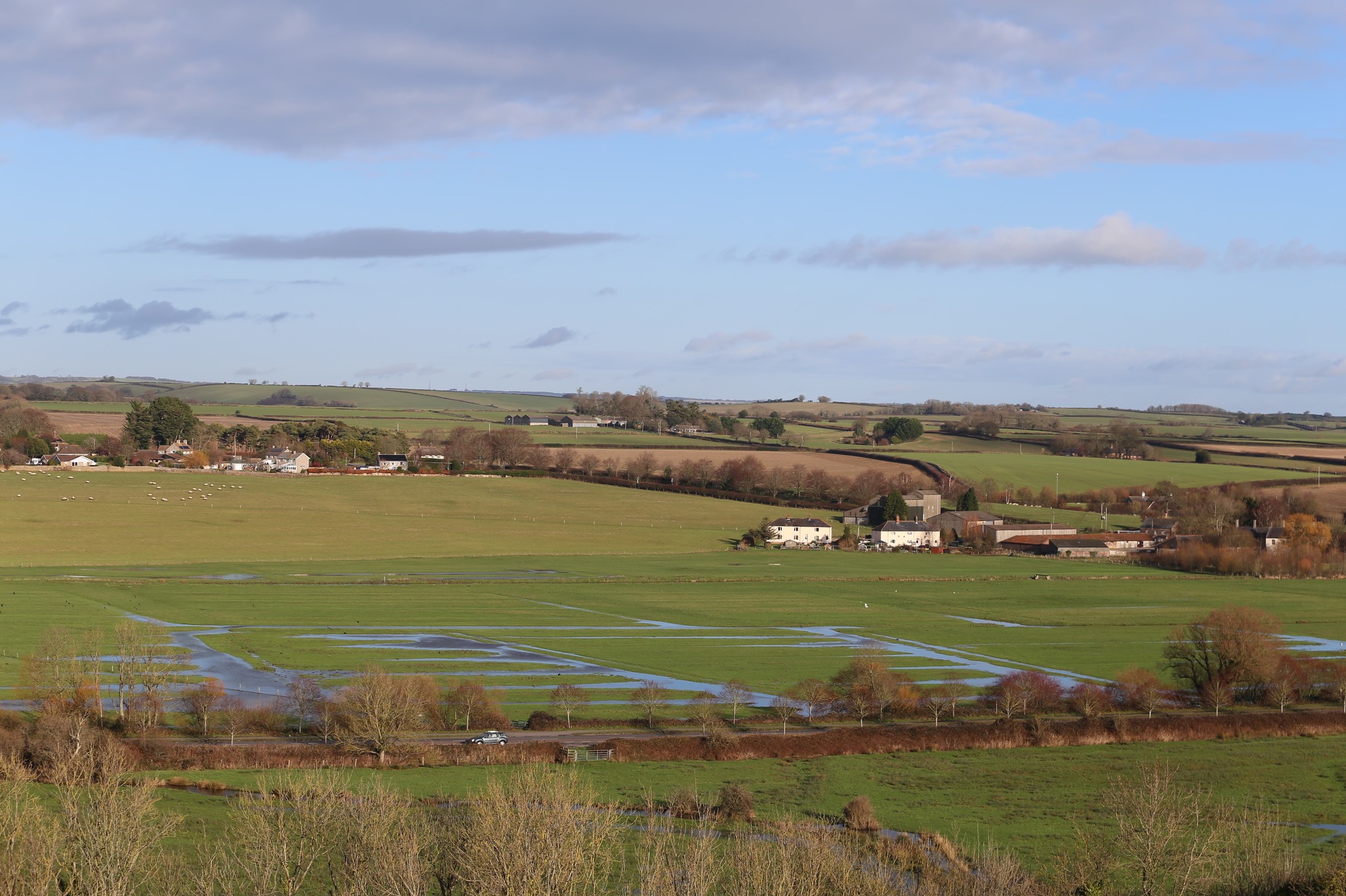 Moreover, many of the earth works, sluices, hatches, drains, causeways, bridges and other apparatus of the water meadows remain in place, sometimes rather worse for wear, at the present time and can be seen in the following examples:
Moreover, many of the earth works, sluices, hatches, drains, causeways, bridges and other apparatus of the water meadows remain in place, sometimes rather worse for wear, at the present time and can be seen in the following examples:• the imposing Ten Hatches weir at Frome Whitfield (Photo 3).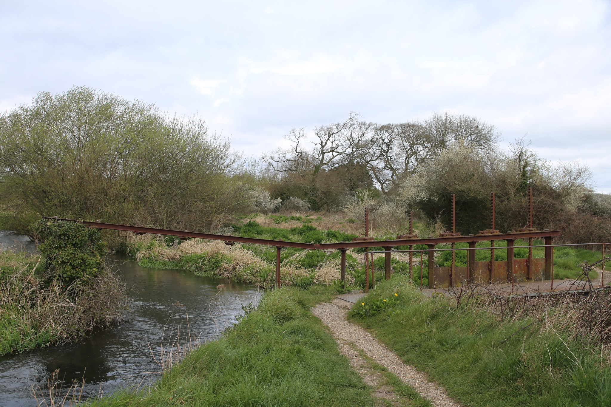
• a small hatch and rachet mechanism (Photo 4).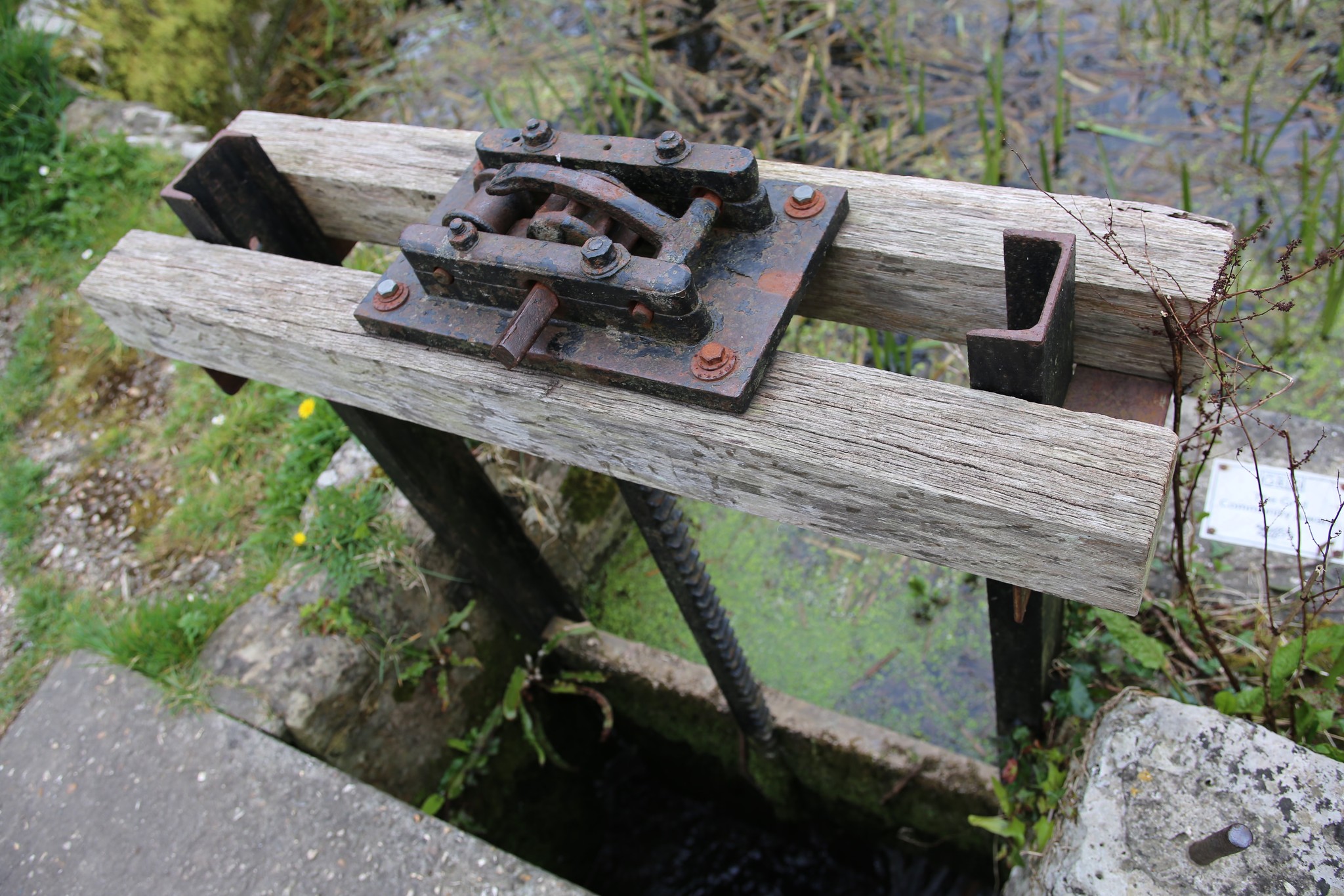
• more substantial hatches complete with their rachet mechanism at John’s Pond (Photo 5).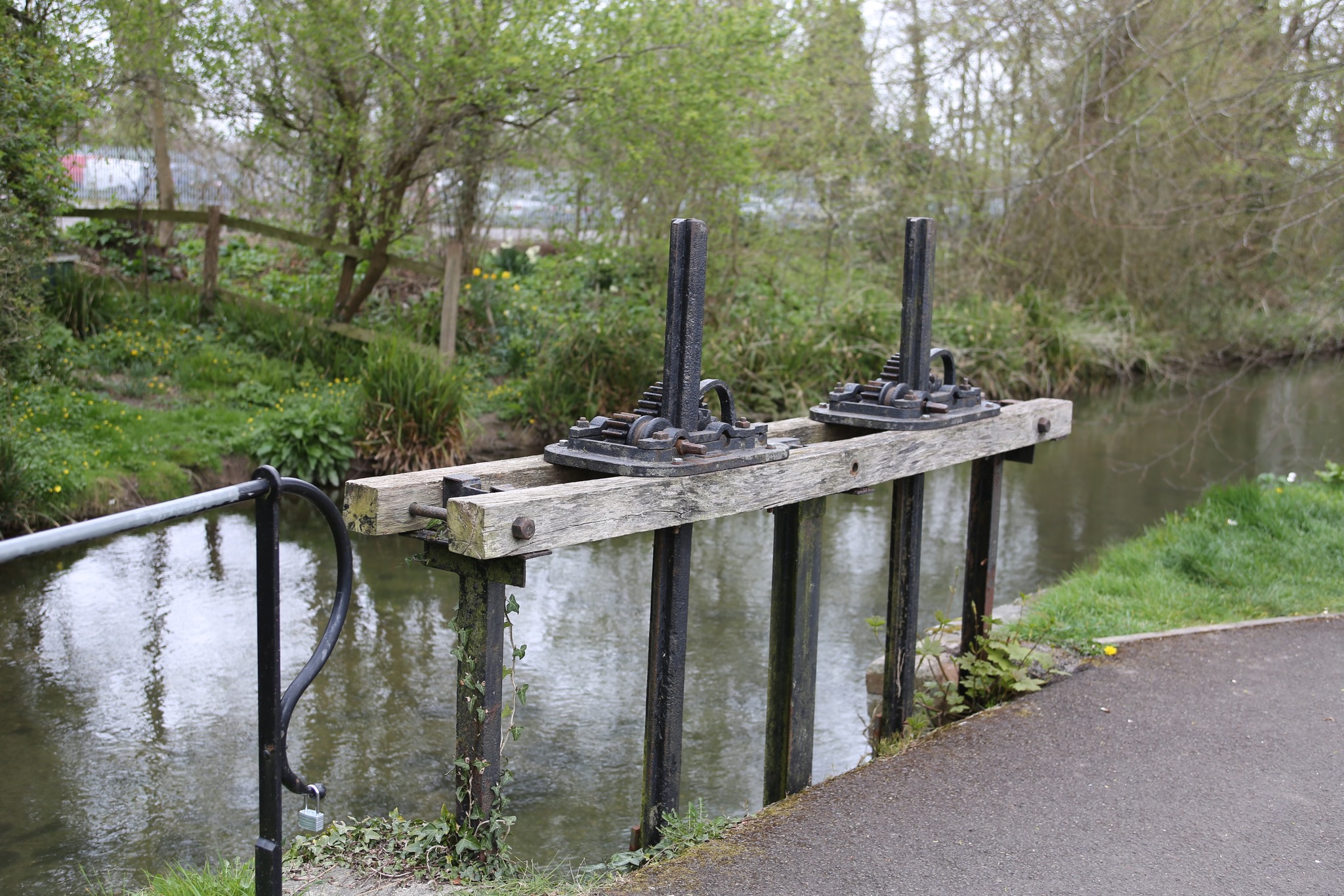
• John’s Pond, probably where the town’s inhabitants deposited the dung from their animals which was then deposited on the land by the stream flowing out of the pond (Photo 6).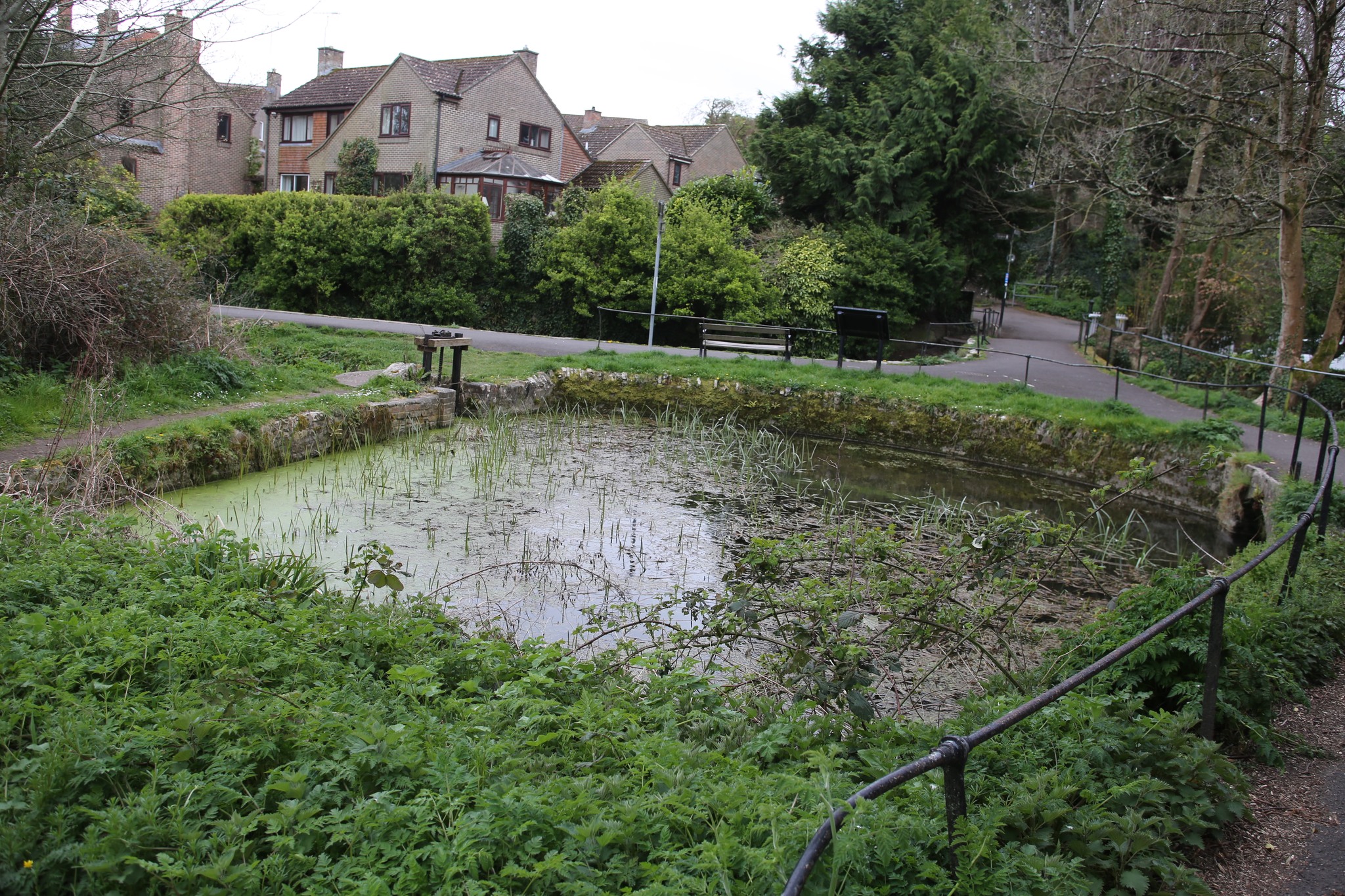
• a ‘Tumble Pool’ at the junction of several drains (Photo 7).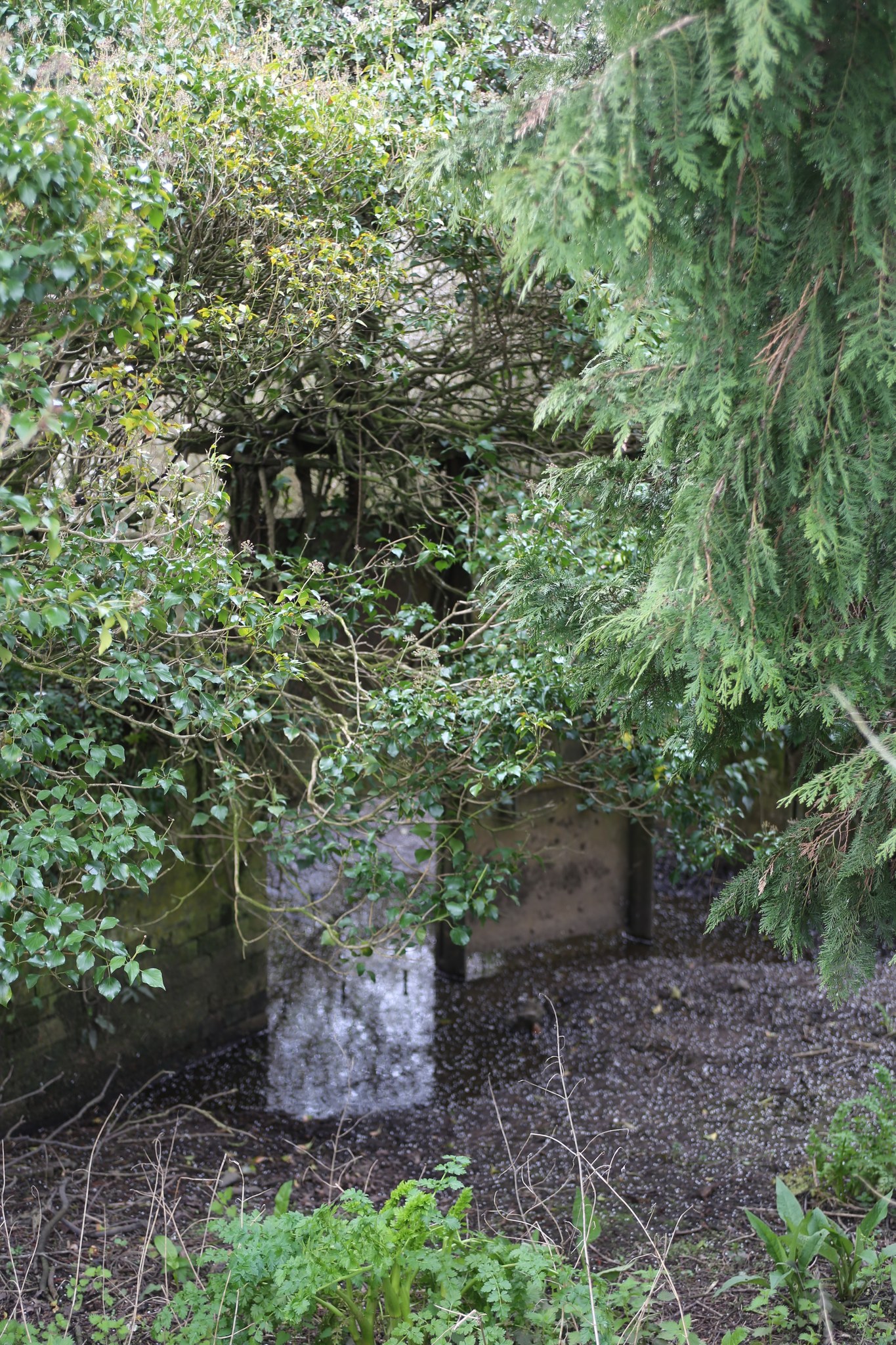
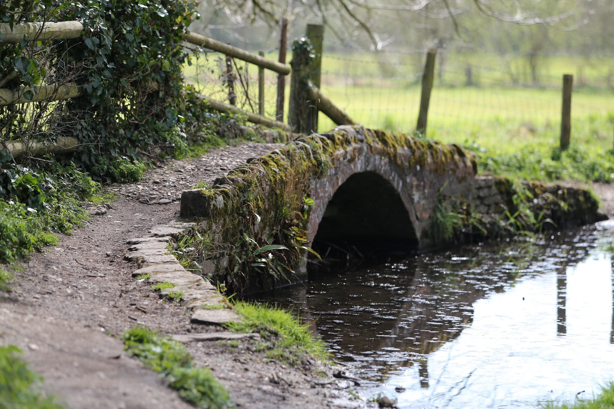
• a 17th century pedestrian bridge and ford at Frome Whitfield (Photo  .
.
• the causeway on the road to Charminster to assist pedestrian travellers when the road flooded (Photo 9).
A small section of water meadow at Britford on the river Avon, just outside Salisbury, has been restored and is managed by a preservation trust (Harnham Water Meadows Trust). Given recent trends in the conservation of the agricultural landscape and the return in favour of natural as opposed to chemical fertilizers, it is far from inconceivable that a similar project could be launched to restore and manage the town’s own historic meadows. In this regard it should be noted that the River Frome has SSSI status and that the maintenance and restoration of the flood plain would greatly enhance its capacity to host fish, birds and other riverside wildlife.
In any event, the area of water meadows lying to the north-west (Charminster), north (Stinsford) and north-east of Dorchester (West Stafford), together with its associated meadows and downland to the north, remains unchanged as a complete agricultural landscape. As such it constitutes a rare survivor and a very important historical landscape which it is essential to preserve in order to be able to ‘read’ the setting of Dorchester and to understand the importance which agriculture has played, and continues to play, from the development of the original pre-Roman settlement through into the modern county town.
Recent Comments