By Ian Gosling, Chair of Dorchester Civic Society
My online activity came to a halt at the end of last year because of issues with my right hand. I am recovering from the surgery to put it right and delighted to be able to pick up the pen once more!
Having surveyed Dorchester’s Ghost Signs in my last blog it seemed logical to move on to the buildings in Dorchester which have disappeared since protection for buildings of architectural or historical significance was introduced after the Second World War by their listing on a national Register introduced by the Town and Country Planning Act of 1947, now administered by Historic England. I have taken the “Register” as my first reference point.
I have taken as a second reference point Volume II Part I from the eight volume “Inventory of the Historical Monuments of the County of Dorset” (The” Inventory”). Volume II was published by the Royal Commission on Historical Monuments in 1970 but the surveying work on which it relies commenced in 1952.
To my surprise fourteen buildings which figure on the Register or in the Inventory no longer exist or have been radically diminished or altered.
The First is the Methodist Church built in South Street on the corner of Durngate Street in 1875, the façade of which resembled a Roman Temple (Photo 1).
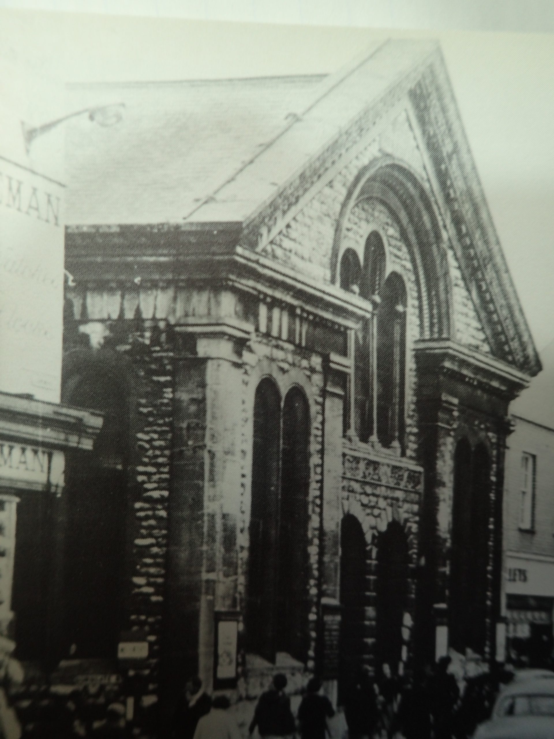
It was demolished in 1981 and replaced by a nondescript red brick building comprising residential accommodation above retail premises at ground floor level, at present occupied by “The Works”. It is not included in the Inventory and appears to never have been listed in the Register.
Nearby in Durngate Street an early 19th century warehouse, situated next to No 7, which was originally a Congregational Chapel has disappeared although it still figures in the Register. On the same side but nearer South Street stood another Chapel, possibly Wesleyan, not included in the Register, which was later incorporated into a printing works.
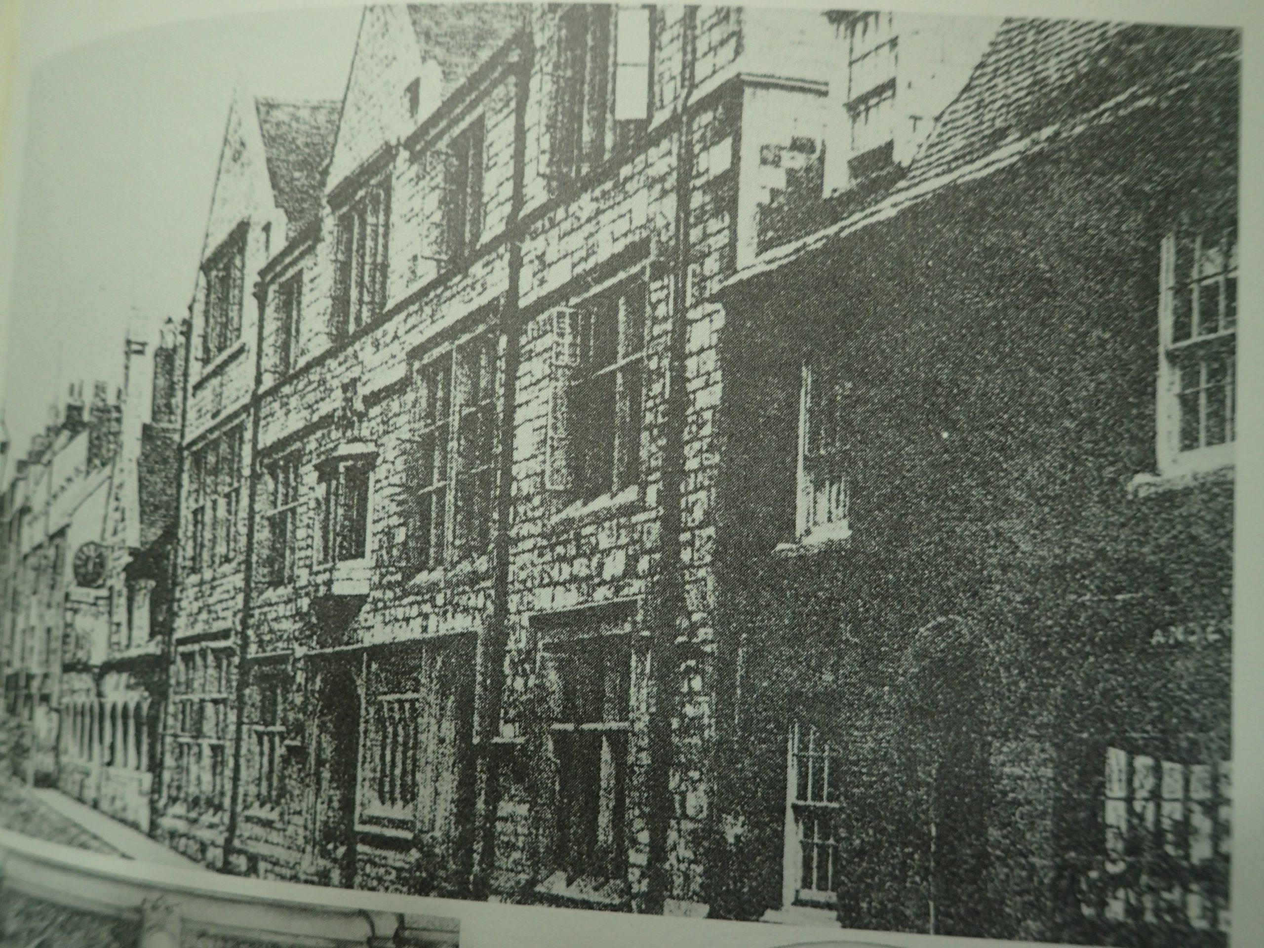
No 22 South Street, a two-storey colour- washed 18th century building with a mansard grey slate roof, housing attics lit by two flat roofed dormer windows, listed in the Register in May 1975, has been replaced by Goulds’ Department Store (Photo 2 shows it on the right-hand side of the original Hardye’s Grammar School building).
Hardyes’ Arcade occupies the site of both the 17th century building which originally housed Hardye’s Grammar School and the Victorian building which replaced it (see the main Jacobean building in Photo 2) until it was moved to new buildings in Fordington in 1927. All that remains of the first building is the wooden hall screen which was the object of my blog of May 2024. The demolished Victorian school building was not listed.
OLYMPUS DIGITAL CAMERA
In nearby Acland Road the gate piers to Wollaston House (still listed Grade II in the Register) have disappeared.
In Colliton Street, formerly known as Pease Lane, a Presbyterian Meeting House (not on the Register but described in the Inventory) was opened at what is now No 22 to provide a Meeting House for the congregation of Protestant Dissenters which had formerly worshipped at the house of Denzil Holles near the Frome. The congregation was subsequently riven with doctrinal differences which led to the building of the breakaway Congregational Chapel in Durngate Street in 1776. The Colliton Street building ceased to be a Meeting House in the late 19th century, and it subsequently housed the Liberal Club, a builder’s yard and then a garage before being demolished in 1976.
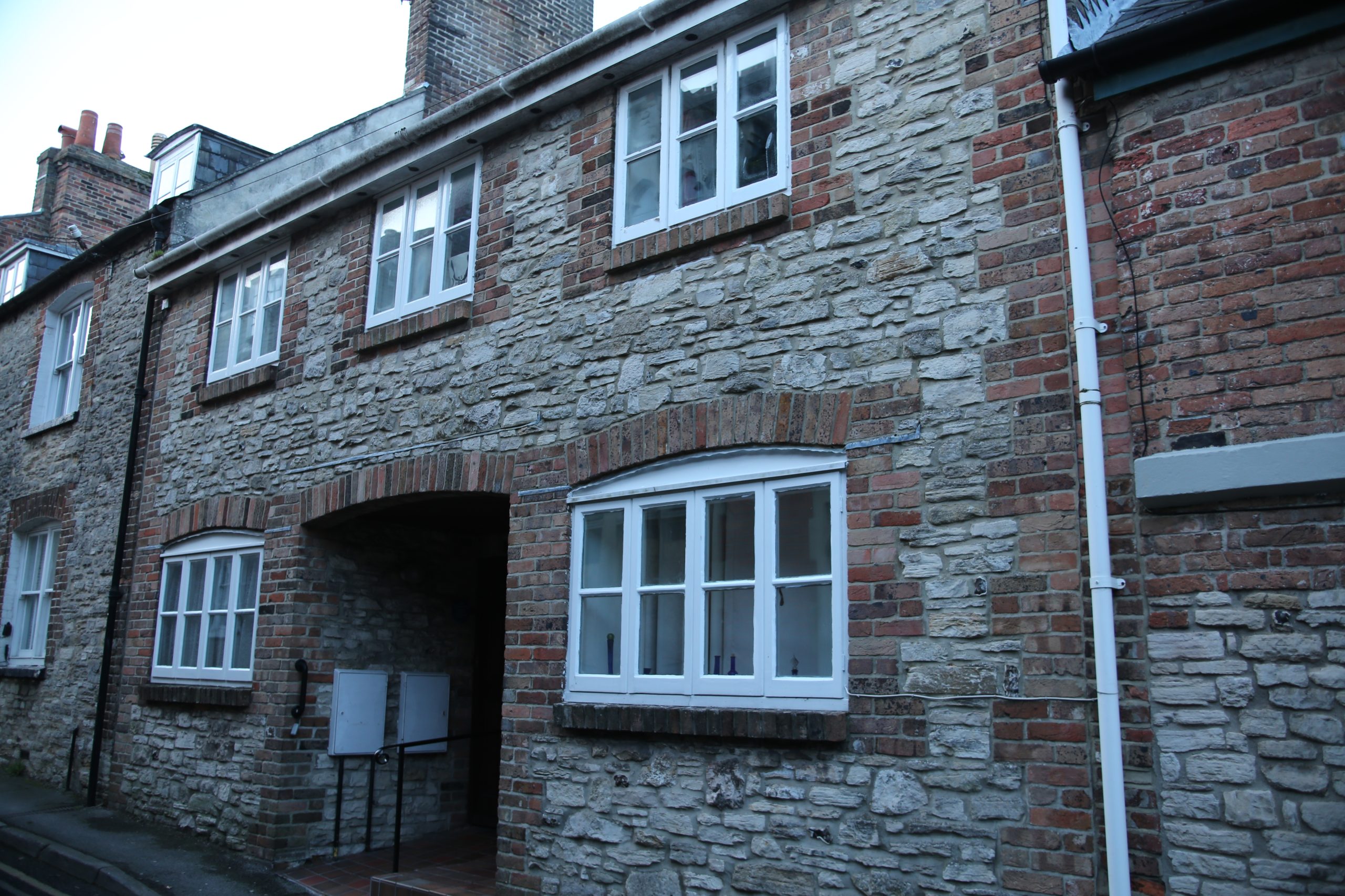
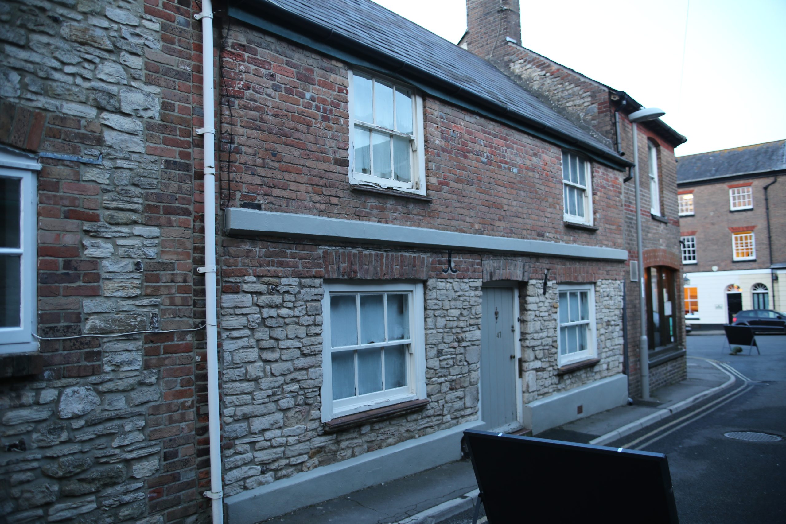
In the same street Numbers 42 and 44 which housed a forge and the blacksmith’s cottage do still survive but have been totally rebuilt since they were listed and the particulars on the Register have not been updated.
The forge (No 42- see Photo 3) was a two-storey house with casement windows built in the early 19th century of Portland rubble with brick dressings and a slate roof, with double planked doors opening directly onto the forge. The ground floor has been altered substantially to turn it into residential use. The last farrier to exercise his trade in the forge up to the 1960s was Lesly Phillips, who served as a mayor of Dorchester after his retirement.
The cottage (Photo 4) probably predates the 18th century, but since it was listed has been almost completely rebuilt and now has a rendered frontage, a tiled roof and modern windows.
The Register includes a No 17, Princes Street, a small house built in the second half of the 18th century of roughcast stone with a pitched tile roof. It was two storeys high, plus attics lit by a dormer with a hipped tiled roof and a casement window. The façade had two ranges of cased sash windows, and the front door was composed of six panels and was protected by a hood held up by brackets. It has vanished, replaced by a fairly recent housing development. In the same street No 4, also 18th century, had been demolished by the time of the publication of the Inventory.
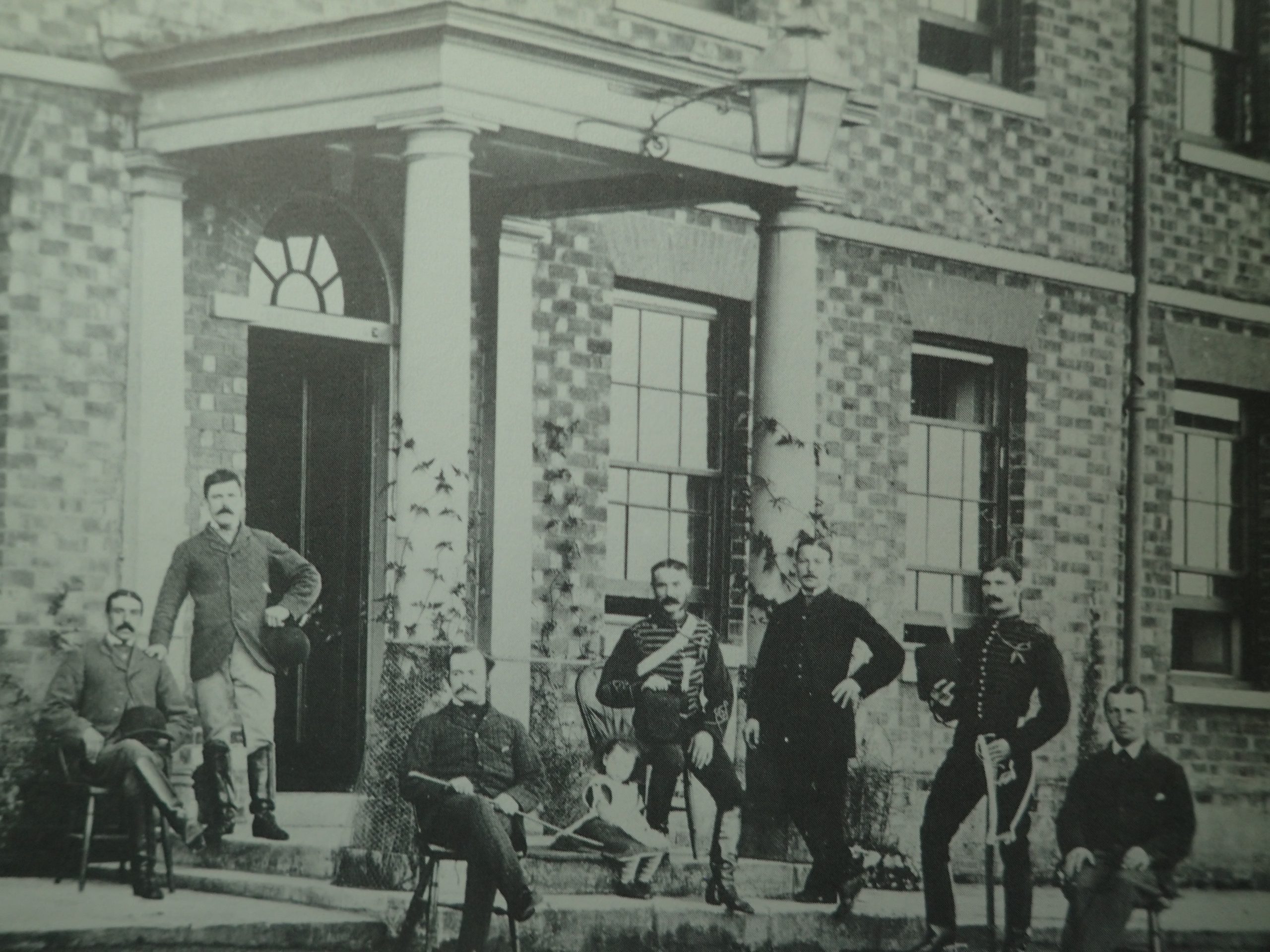
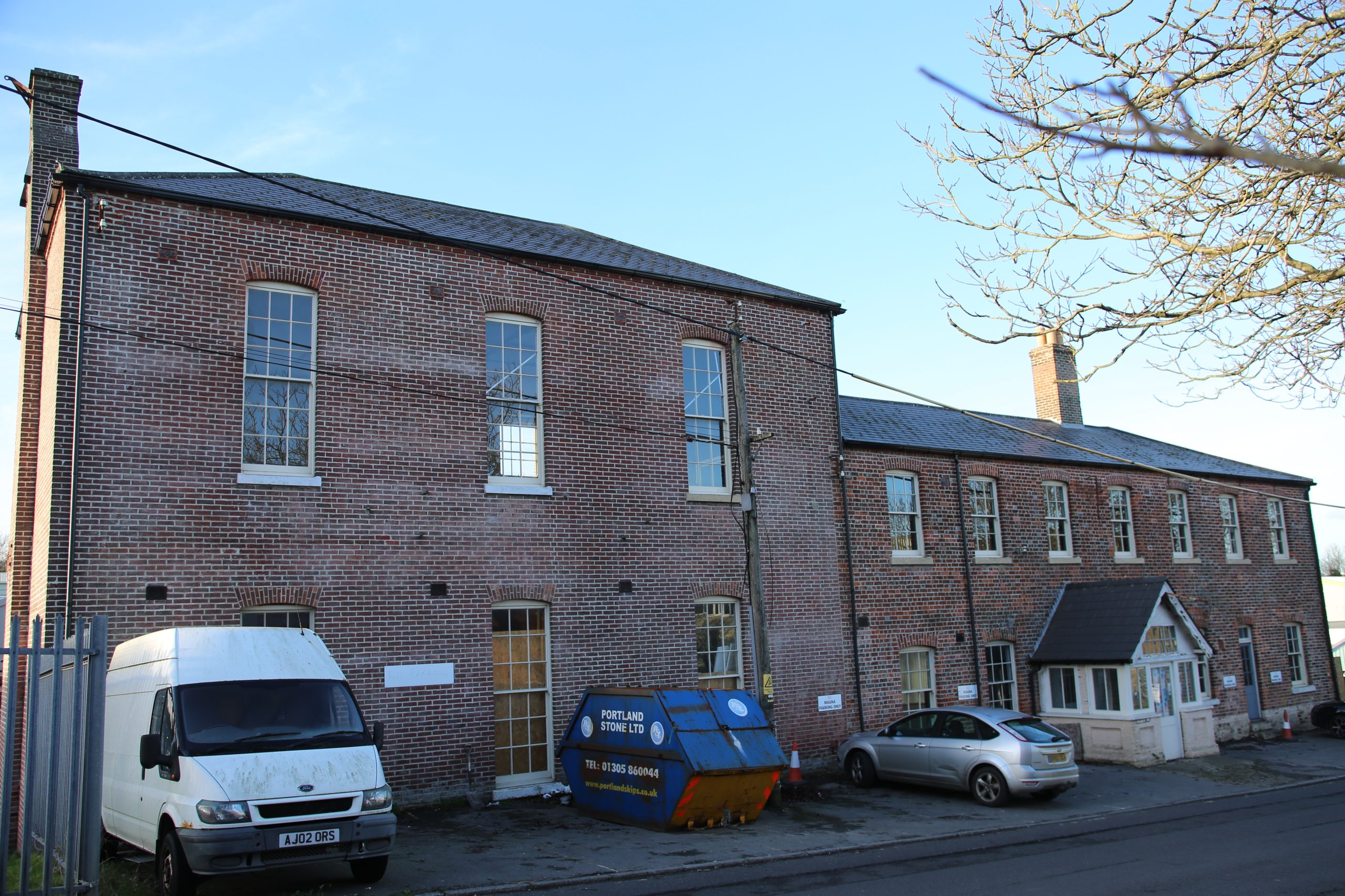
At the Top of Town, the late 18th century barrack complex, mentioned in my blog on the Dorset Militia in October 2025, has lost one of its most imposing buildings which housed the Married Quarters. It was a big E-shaped two storey building, comprised of a main block with eleven bays, a porch in the centre and wings on either side. Its façade was built of brick, part of which was rendered and covered with a grey slate roof (Photo 5).
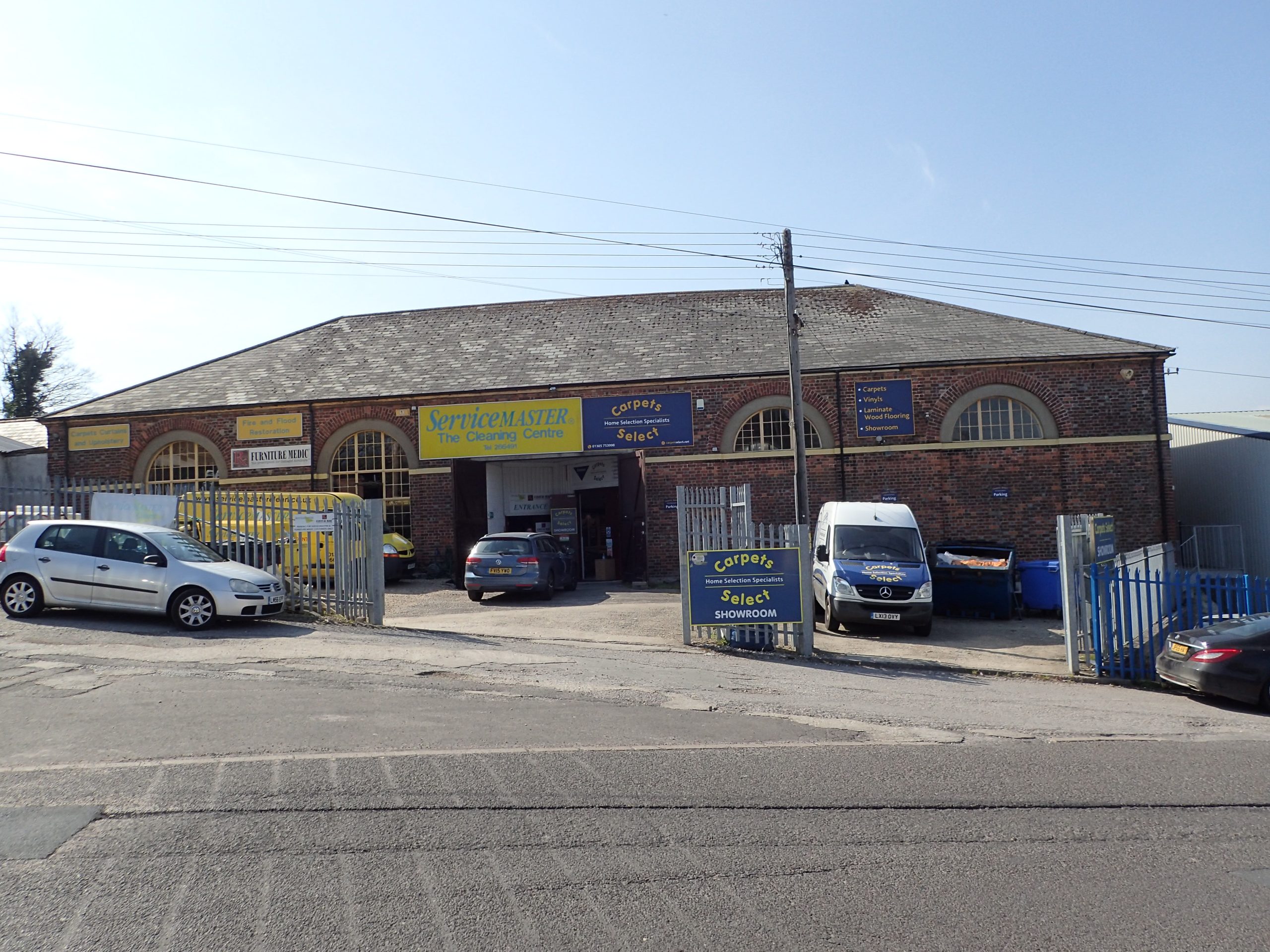
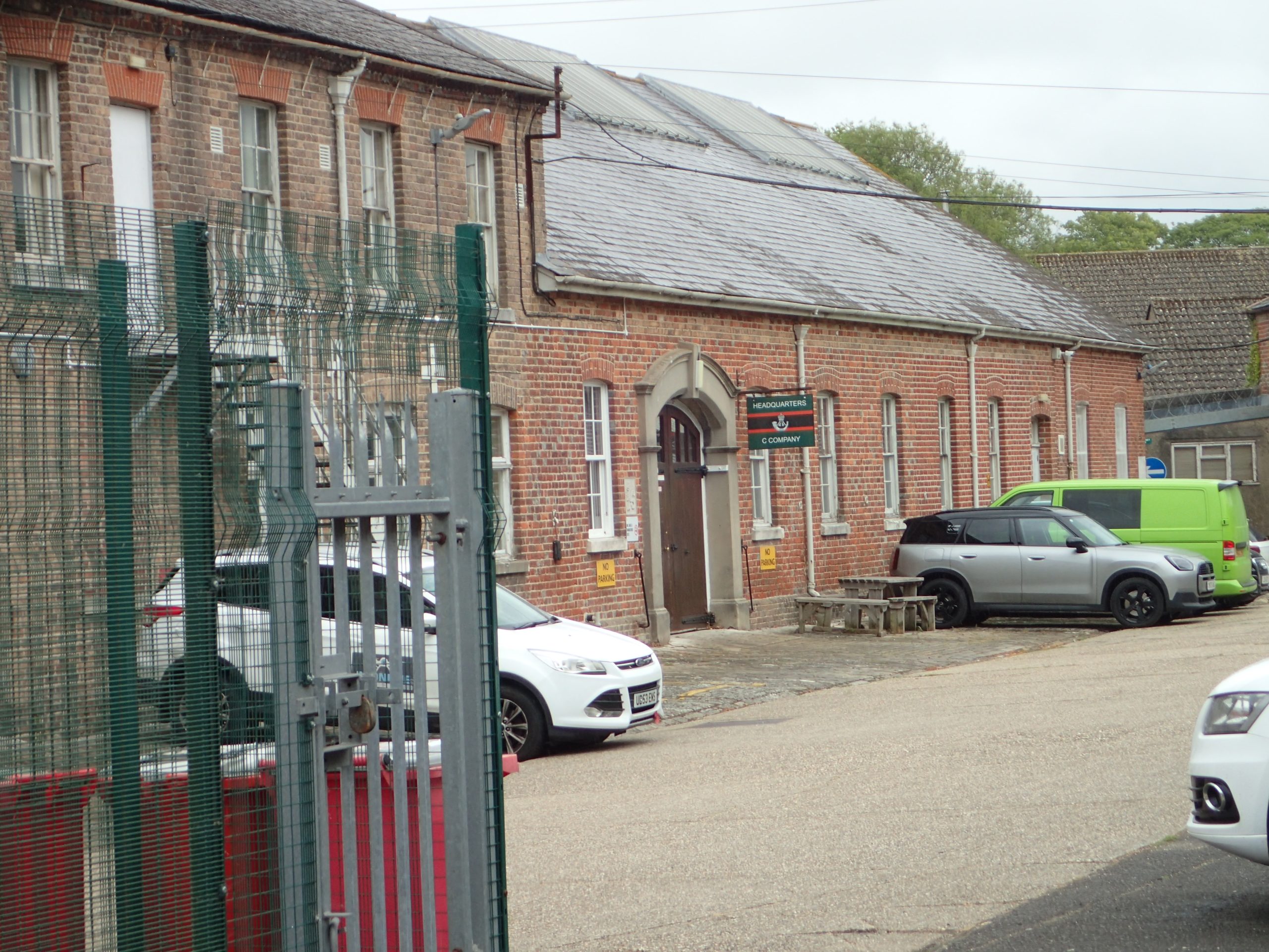
The Riding School (Photo 6), the former Military Hospital (Photo 7) altogether with the guardroom, administrative building, drill hall, (Photo 8), cookhouses, storehouses and former barns all remain.
Fordington was originally a collection of farms and barns occupied by farmers who exploited the fields adjacent to the village owned by the Duchy of Cornwall. Two of these groups of farmhouses, barns and stabling have disappeared in recent times and have been replaced by modern housing developments.
The first (listed in August 1974) situated at no. 24 Allington Road, dated from the mid-19th century and was built of Portland or Ridgeway stone with brick dressings and a slate roof. It was flanked by stables. Its barn stood at what is now no. 34 in that road and was of similar date and constructed in the same materials.
In nearby Kings’ Road the farm buildings north of nos.19 and 21 have also been replaced by modern housing, as has the former Slaughterhouse next door.
These farm buildings (listed in May 1975) were earlier than those in Allington Road since they could be dated to the 18th c, or even earlier. They were constructed of coursed Ridgeway rubble and partly colour-washed with hipped pan tiled roofs.
The slaughterhouse (listed in May 1975) also dated back to at least the 18th c but was built of stone rubble and entirely colour washed. It had a hipped thatched roof and a projecting porch.
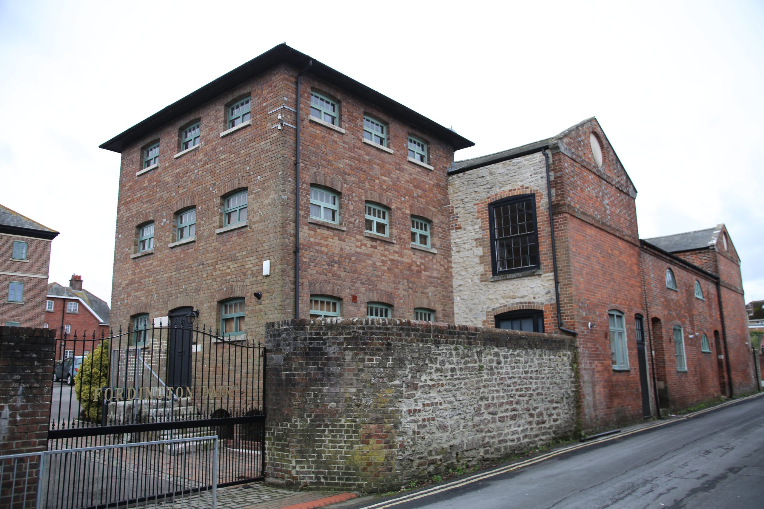
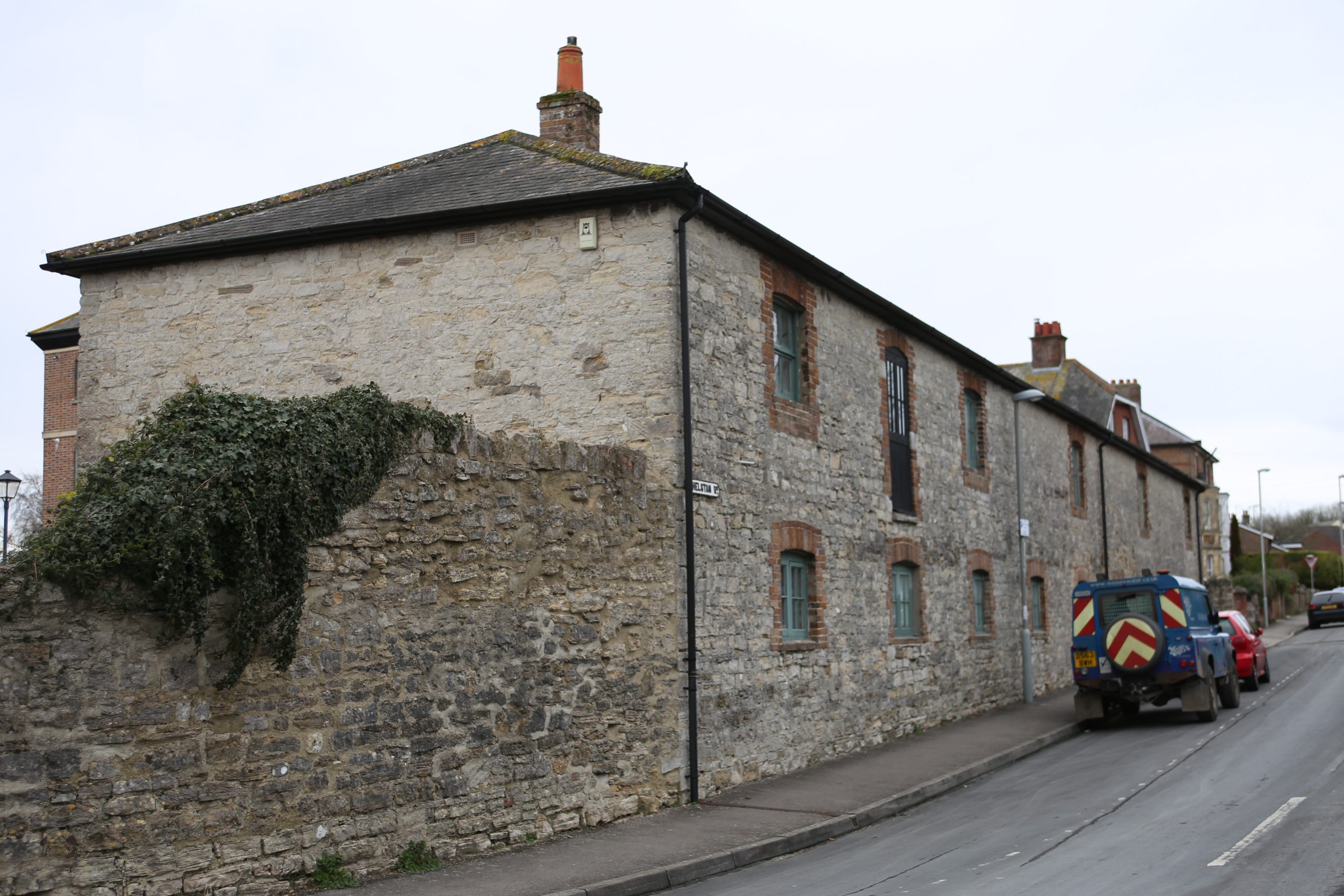
The loss of these iconic buildings is regrettable since the barn and associated buildings at 5-6 Little Britain and the farm buildings and stables which formerly formed part of Fordington House in Kings Road and Athelstan Road have all been successfully transformed into characterful residential accommodation (Photos 9 and 10).
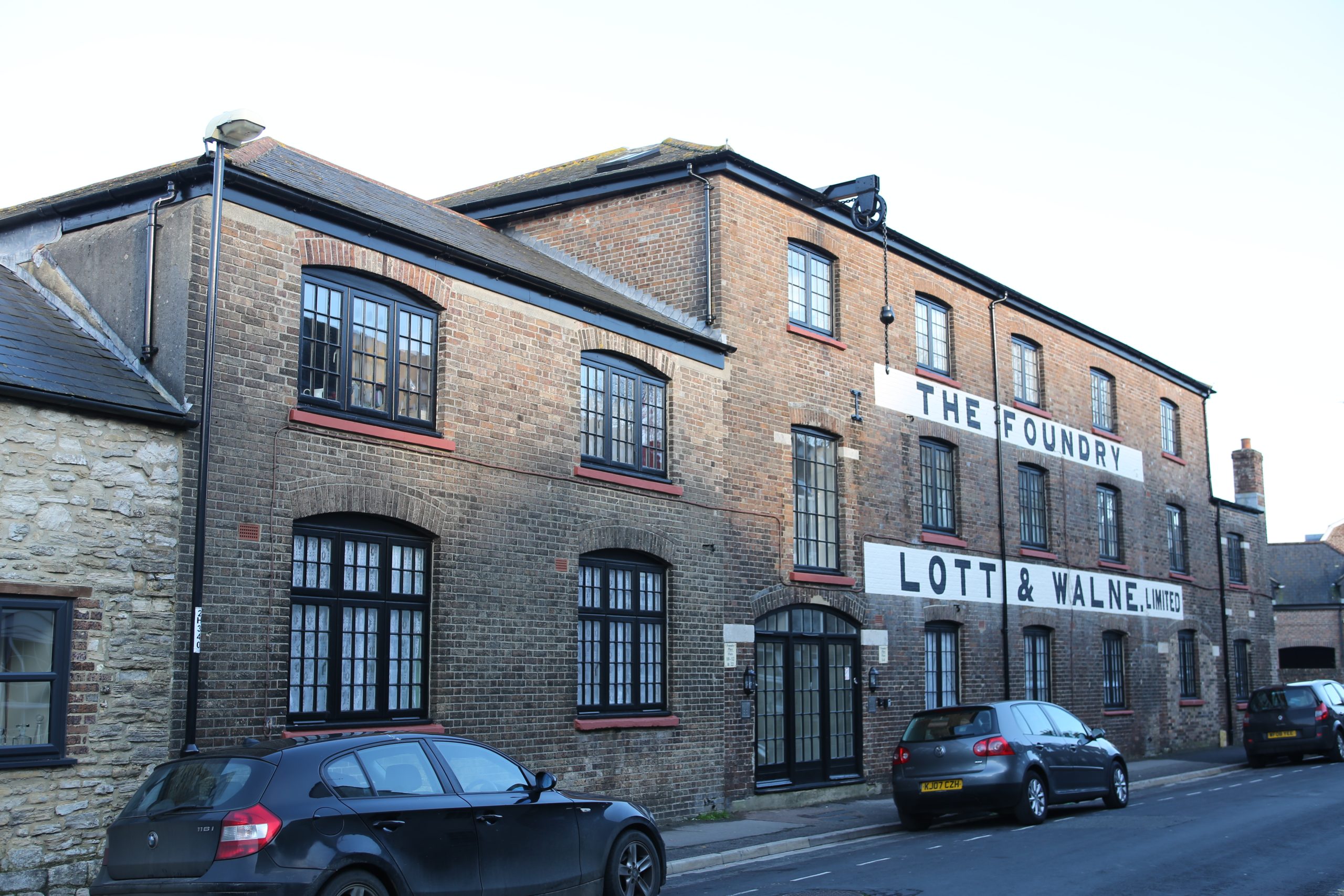
Dorchester and Fordington have lost most of their past industrial buildings. The main exception is of course the Eldridge Pope Brewery which has been transformed into a leisure and housing complex. The 19th c Lott & Walne Foundry and the 18th c Malt House next to it also survive, both transformed into apartments together with the former East Mill, also converted into housing. (Photo 11).
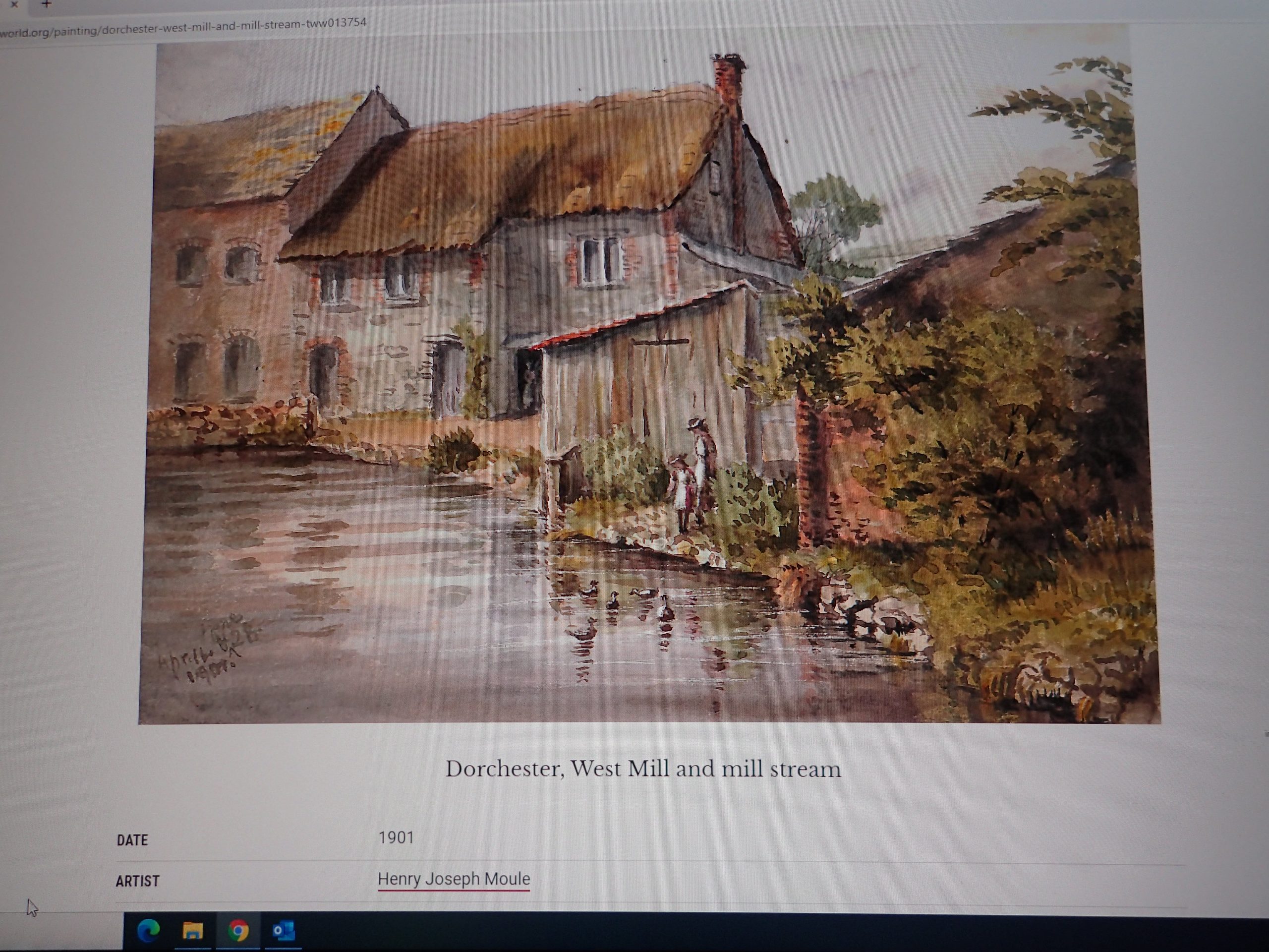
The numerous other Malt Houses which can be located disseminated throughout the town in the first Ordnance Survey map of 1898 have all been demolished and West Mills (Photo 12) which was described in the Inventory has also vanished except for the fragments which remain of the sluice gates (see my blog of March 2025). There remains no evidence of the former Edisson steam tractor and roller works.
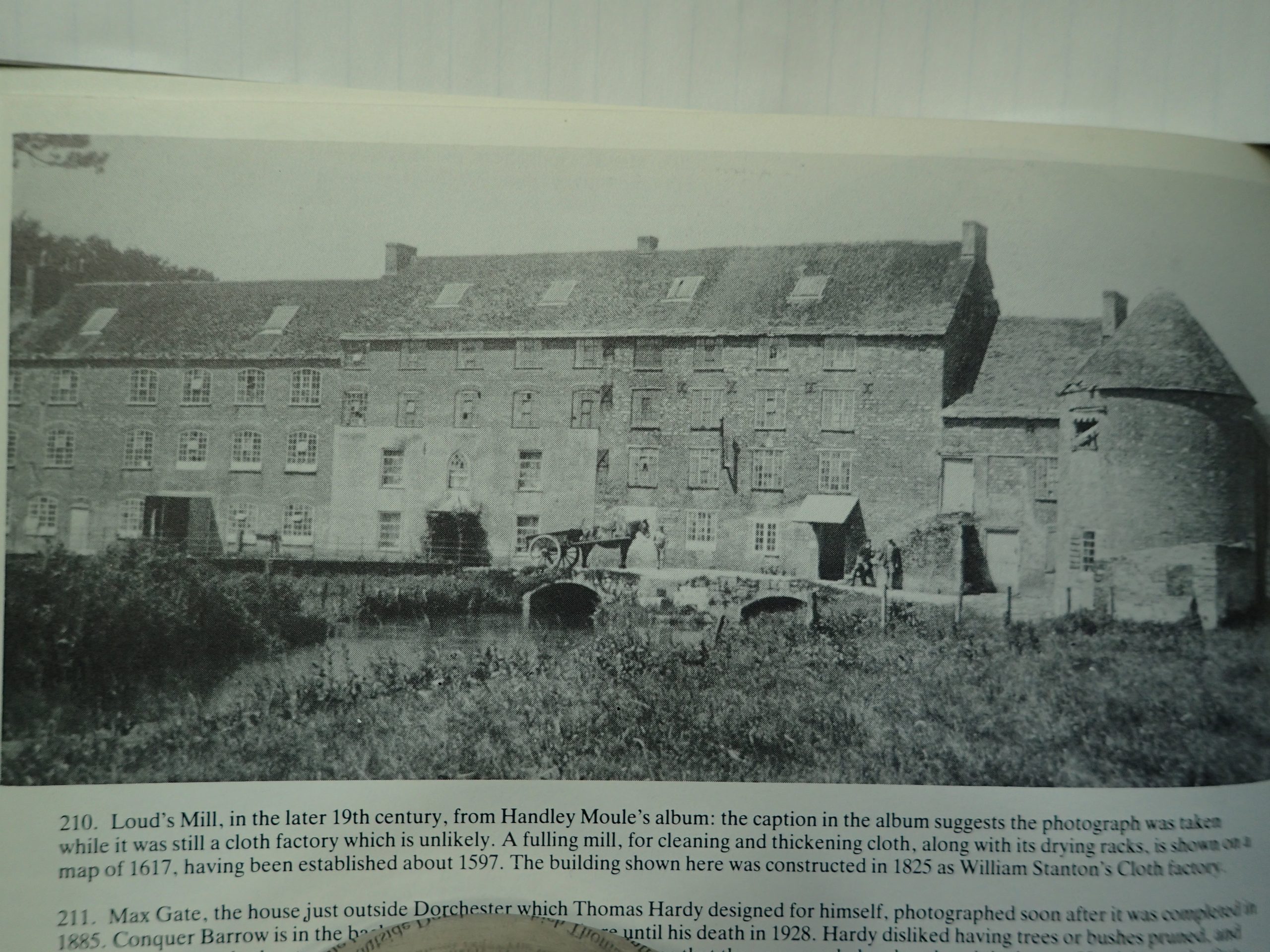
Perhaps the most grievous loss is that of the exceptional late 18th c worsted mill buildings owned by William Stanton Ltd at Louds Mill. Listed as late as in January 1972 it was still more or less complete in 1998. Even today it is included in the Register. Annexed is a Victorian photograph of the main building (Photo 13)
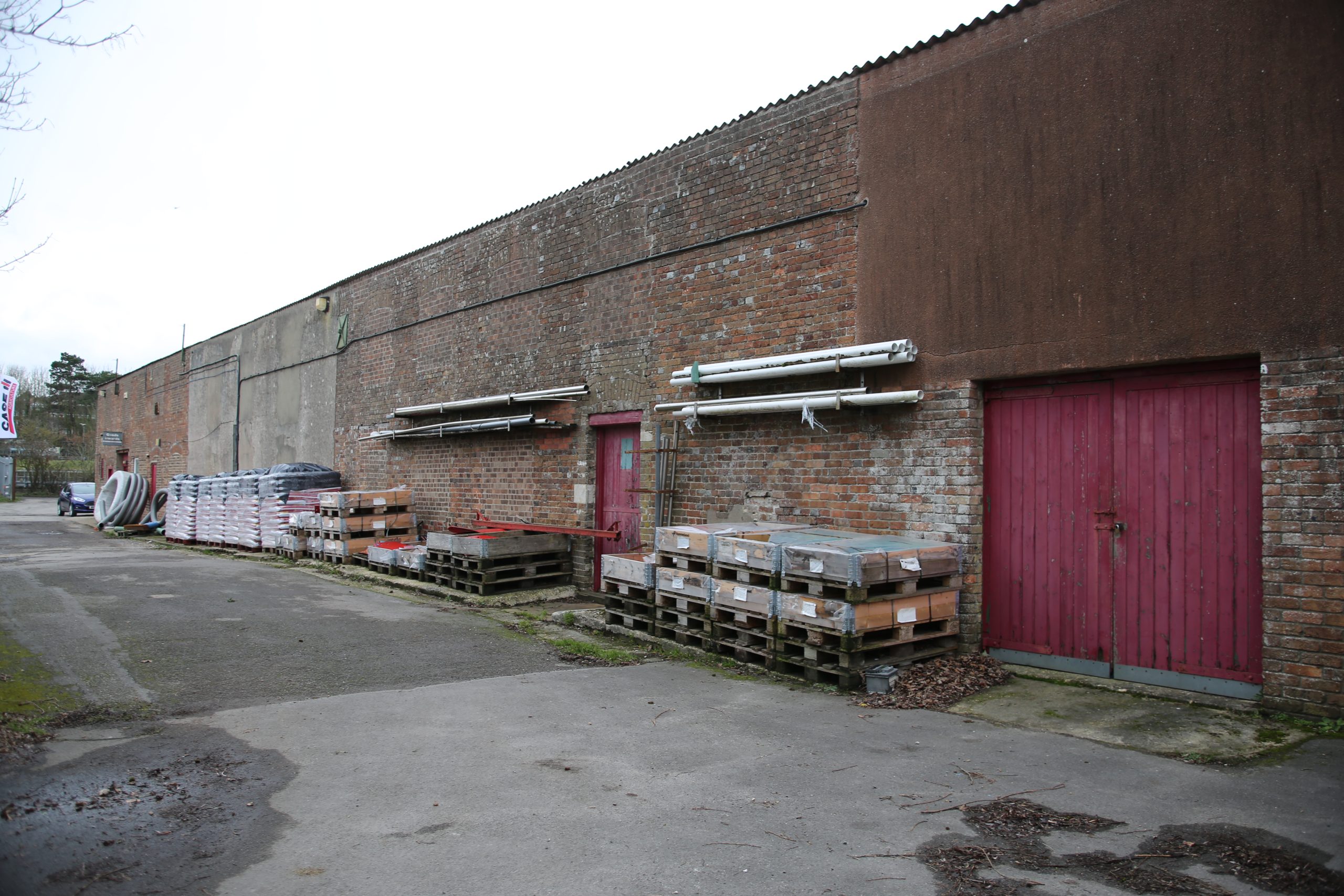
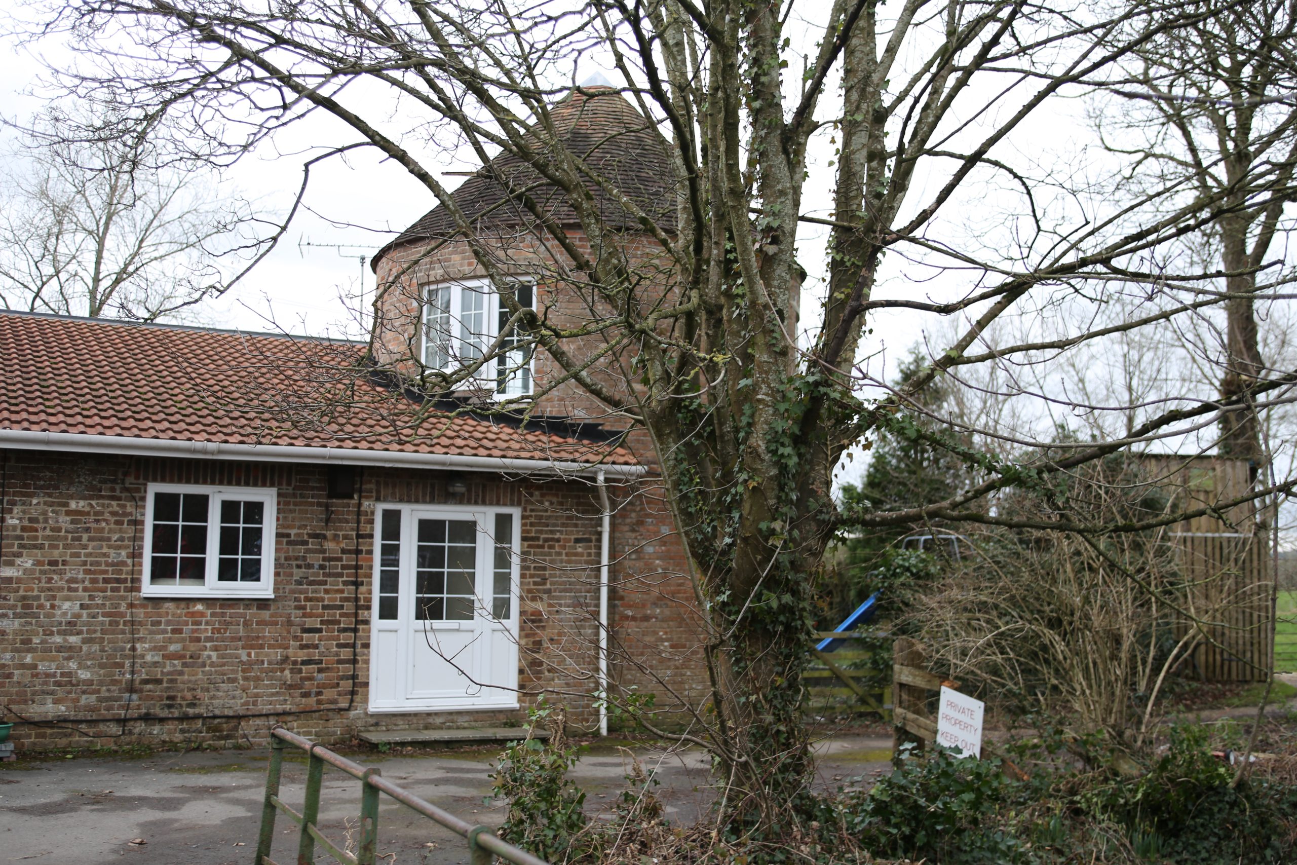
Fragments of the facades can be seen in the premises of the agricultural equipment dealer near to the recycling centre (Photo 14) and at the far end the former hay store remains, converted into residential use (Photo 15).
I have come across references to two listed houses in Charles Street (Nos 41 and 43) which no longer exist, which are not mentioned in the Inventory, and which were apparently listed, but no longer figure in the Register. Does anybody have further details of them?
In addition, I would be very interested to see any photos of the buildings mentioned above not illustrated by photos which readers may possess.
IFBG 16.5.26
PHOTOS
- Methodist church May 25.
- 22 South Street May 25.
- 42 Colliton street CS 37.
- 44 Colliton Street CS 38.
- Married Quarters May 25.
- Riding School CS 44.
- Military Hospital CS46.
- Drill Hall etc May 25.
- King’s road Canon Jan 19, 106.
- Athelstan road CS 80
- East Mill Canon June 21, 4130.
- West Mill CS 60.
- Loud’s Mill historic May 25.
- Loud’s Mill now CS 65.
- Hay Store CS 69.
The First is the Methodist Church built in South Street on the corner of Durngate Street in 1875, the façade of which resembled a Roman Temple (Photo 1). It was demolished in 1981 and replaced by a nondescript red brick building comprising residential accommodation above retail premises at ground floor level, at present occupied by “The Works”. It is not included in the Inventory and appears to never have been listed in the Register.
Nearby in Durngate Street an early 19th century warehouse, situated next to No 7, which was originally a Congregational Chapel has disappeared although it still figures in the Register. On the same side but nearer South Street stood another Chapel, possibly Wesleyan, not included in the Register, which was later incorporated into a printing works.
No 22 South Street, a two-storey colour- washed 18th century building with a mansard grey slate roof, housing attics lit by two flat roofed dormer windows, listed in the Register in May 1975, has been replaced by Goulds’ Department Store (Photo 2 shows it on the right-hand side of the original Hardye’s Grammar School building).
Hardyes’ Arcade occupies the site of both the 17th century building which originally housed Hardye’s Grammar School and the Victorian building which replaced it (see the main Jacobean building in Photo 2) until it was moved to new buildings in Fordington in 1927. All that remains of the first building is the wooden hall screen which was the object of my blog of May 2024. The demolished Victorian school building was not listed.
In nearby Acland Road the gate piers to Wollaston House (still listed Grade II in the Register) have disappeared.
In Colliton Street, formerly known as Pease Lane, a Presbyterian Meeting House (not on the Register but described in the Inventory) was opened at what is now No 22 to provide a Meeting House for the congregation of Protestant Dissenters which had formerly worshipped at the house of Denzil Holles near the Frome. The congregation was subsequently riven with doctrinal differences which led to the building of the breakaway Congregational Chapel in Durngate Street in 1776. The Colliton Street building ceased to be a Meeting House in the late 19th century, and it subsequently housed the Liberal Club, a builder’s yard and then a garage before being demolished in 1976.
In the same street Numbers 42 and 44 which housed a forge and the blacksmith’s cottage do still survive but have been totally rebuilt since they were listed and the particulars on the Register have not been updated.
The forge (No 42- see Photo 3) was a two-storey house with casement windows built in the early 19th century of Portland rubble with brick dressings and a slate roof, with double planked doors opening directly onto the forge. The ground floor has been altered substantially to turn it into residential use. The last farrier to exercise his trade in the forge up to the 1960s was Lesly Phillips, who served as a mayor of Dorchester after his retirement.
The cottage (Photo 4) probably predates the 18th century, but since it was listed has been almost completely rebuilt and now has a rendered frontage, a tiled roof and modern windows.
The Register includes a No 17, Princes Street, a small house built in the second half of the 18th century of roughcast stone with a pitched tile roof. It was two storeys high, plus attics lit by a dormer with a hipped tiled roof and a casement window. The façade had two ranges of cased sash windows, and the front door was composed of six panels and was protected by a hood held up by brackets. It has vanished, replaced by a fairly recent housing development. In the same street No 4, also 18th century, had been demolished by the time of the publication of the Inventory.
At the Top of Town, the late 18th century barrack complex, mentioned in my blog on the Dorset Militia in October 2025, has lost one of its most imposing buildings which housed the Married Quarters. It was a big E-shaped two storey building, comprised of a main block with eleven bays, a porch in the centre and wings on either side. Its façade was built of brick, part of which was rendered and covered with a grey slate roof (Photo 5). The Riding School (Photo 6), the former Military Hospital (Photo 7) altogether with the guardroom, administrative building, drill hall, (Photo 8), cookhouses, storehouses and former barns all remain.
Fordington, was originally a collection of farms and barns occupied by farmers who exploited the fields adjacent to the village owned by the Duchy of Cornwall. Two of these groups of farmhouses, barns and stabling have disappeared in recent times and have been replaced by modern housing developments.
The first (listed in August 1974) situated at no. 24 Allington Road, dated from the mid-19th century and was built of Portland or Ridgeway stone with brick dressings and a slate roof. It was flanked by stables. Its barn stood at what is now no. 34 in that road and was of similar date and constructed in the same materials.
In nearby Kings’ Road the farm buildings north of nos.19 and 21 have also been replaced by modern housing, as has the former Slaughterhouse next door.
These farm buildings (listed in May 1975) were earlier than those in Allington Road since they could be dated to the 18th c, or even earlier. They were constructed of coursed Ridgeway rubble and partly colour-washed with hipped pan tiled roofs.
The slaughterhouse (listed in May 1975) also dated back to at least the 18th c but was built of stone rubble and entirely colour washed. It had a hipped thatched roof and a projecting porch.
The loss of these iconic buildings is regrettable since the barn and associated buildings at 5-6 Little Britain and the farm buildings and stables which formerly formed part of Fordington House in Kings Road and Athelstan Road have all been successfully transformed into characterful residential accommodation (Photos 9 and 10).
Dorchester and Fordington have lost most of their past industrial buildings. The main exception is of course the Pope Brewery which has been transformed into a leisure and housing complex. The 19th c Lott & Walne Foundry and the 18th c Malt House next to it also survive, both transformed into apartments together with the former East Mill, also converted into housing. (Photo 11).
Th numerous other Malt Houses which can be located disseminated throughout the town in the first Ordnance Survey map of 1898 have all been demolished and West Mills (Photo 12) which was described in the Inventory has also vanished except for the fragments which remain of the sluice gates (see my blog of March 2025). There remains no evidence of the former Edisson steam tractor and roller works.
Perhaps the most grievous loss is that of the exceptional late 18th c worsted mill buildings owned by William Stanton Ltd at Louds Mill. Listed as late as in January 1972 it was still more or less complete in 1998. Even today it is included in the Register. Annexed is a Victorian photograph of the main building (Photo 13)
Fragments of the facades can be seen in the premises of the agricultural equipment dealer near to the recycling centre (Photo 14) and at the far end the former hay store remains, converted into residential use (Photo 15).
I have come across refences to two listed houses in Charles Street (Nos 41 and 43) which no longer exist, which are not mentioned in the Inventory, and which were apparently listed, but no longer figure in the Register. Does anybody have further details of them?
In addition, I would be very interested to see any photos of the buildings mentioned above not illustrated by photos which readers may possess.
IFBG 16.5.26
PHOTOS
- Methodist church May 25.
- 22 South Street May 25.
- 42 Colliton street CS 37.
- 44 Colliton Street CS 38.
- Married Quarters May 25.
- Riding School CS 44.
- Military Hospital CS46.
- Drill Hall etc May 25.
- King’s road Canon Jan 19, 106.
- Athelstan road CS 80
- East Mill Canon June 21, 4130.
- West Mill CS 60.
- Loud’s Mill historic May 25.
- Loud’s Mill now CS 65.
- Hay Store CS 69.
Recent Comments